2,300+ results for map of pa
- Vintage 1949 City of Uniontown, PA Fayette County Federal Housing Projects MapOpens in a new window or tabPre-Owned$8.000 bids · Time left8d 9h left (06/09, 04:14 AM)+$5.07 shippinguniquefinds50 (1,480) 100%
- 1876 Plat Map ~ CITY of TITUSVILLE - WARDS 1 & 2, CRAWFORD Co., PA -#033Opens in a new window or tab$34.000 bids · Time left18h 46m left (Sat, 01:16 PM)Free shippingmaphatter (7,644) 99.6%
- 1872 antique hand colored MAP pa CUMBERLAND FRANKLIN ADAMS co 17.25"x13.75"Opens in a new window or tab$67.50+$11.80 shippingFree returnsTop Rated Plusantique.cottage (12,559) 100%
- Philadelphia, PA - Original 1910 Dated City Map by Dodd Mead & CompanyOpens in a new window or tab$38.00Free shippingFree returns20% off 5+Top Rated Plusalazarus (5,493) 100%
- Old 1895 X-Large 28"x22" Rand McNally Atlas Map ~ PHILADELPHIA, PA ~ Free S&HOpens in a new window or tab$45.95Was: $48.886% offFree shippingFree returnsmaphatter (7,644) 99.6%
- Vintage 1900 PHILADELPHIA PENNSYLVANIA Map 22"x14" Old Antique Original PAOpens in a new window or tab$35.99Was: $49.9928% offFree shippinguncommon_maps (2,933) 100%
- Cameron-Elk PA Counties 1958 Waters-Highway Map 1966 Deer&Bear Harvest ReportOpens in a new window or tab$15.00+$4.50 shippingpaknockerstiffer (866) 100%
- 1857 Colton Atlas Map ~ PHILADELPHIA, PENNSYLVANIA ~ (14x17) ~ Free S&H -#498Opens in a new window or tab$34.000 bids · Time left3d 22h left (Tue, 05:02 PM)Free shippingFree returnsmaphatter (7,644) 99.6%
- 1876 Plat Map ~ CITY of TITUSVILLE - WARDS 3 & 4, CRAWFORD Co., PA -#032Opens in a new window or tab$34.000 bids · Time left19h 10m left (Sat, 01:40 PM)Free shippingmaphatter (7,644) 99.6%
- 1904 Map of 1764 Map Diagram Disposition of PA Troops in Western District WinterOpens in a new window or tabPre-Owned$31.45Was: $37.0015% off+$6.70 shippingmemaps (3,970) 100%
- 1872 Hand-Colored Atlas Map Of New Oxford, Adams Co., PA 14.75” x 21”Opens in a new window or tab$50.00+$14.80 shippingrobinrarebooks (2,325) 100%
- 1885 McNally Map - Pennsylvania - Philadelphia Pittsburgh Erie Harrisburg - PAOpens in a new window or tab$16.00Was: $20.0020% off+$4.99 shippingFree returnsTop Rated Plusc574778 (15,785) 99.6%
- 1842 Large Map of Pennsylvania. From Morse's North American AtlasOpens in a new window or tab$135.00+$12.00 shippingbook14850 (3,441) 99.3%
- 1897 MAP of BOROUGH of ROCKLEDGE & JENKINTOWN MONTGOMERY CO PAOpens in a new window or tab$129.99+$9.80 shippingredlands66 (6,641) 98.9%
- Philadelphia PA Old USGS Topographical Geological Survey Quadrangle Topo MapOpens in a new window or tab$9.95+$7.83 shippingFree returnsTop Rated Plusoldsol (14,873) 100%
- 1857 Colton Atlas Map ~ THE STATE of PENNSYLVANIA ~ (14x17) ~ Free S&H -#497Opens in a new window or tab$34.000 bids · Time left3d 22h left (Tue, 05:12 PM)Free shippingFree returnsmaphatter (7,644) 99.6%
- Antique Map 1914 City Of Pittsburgh PA 11x15 InchesOpens in a new window or tab$19.50+$4.68 shippingbenjter-51 (222) 100%
- 1896 Map ~ VACINITY of PHILADELPHIA, PENNSYLVANIA ~ (11x13)Free S&H-#037Opens in a new window or tab$27.15Was: $28.886% offFree shippingmaphatter (7,644) 99.6%
- 1864 BRIDGENS' PLAT ATLAS OF LANCASTER CO., PA-MAP OF ELIZABETHTOWN & ADAMSTOWNOpens in a new window or tab$10.00+$7.00 shippingsajek (12,303) 100%
- Bridgen Atlas 1864 Antique Colored Map of Earl Township Lancaster County PA VGOpens in a new window or tab$35.00+$5.87 shippingdogstarbooks (1,221) 100%
- C. 1880 Map Of Phoenixville, (Part 3) PA Hand-Colored 20 x 28” Double-Page-Opens in a new window or tab$24.95+$18.80 shippingrobinrarebooks (2,325) 100%
- Tioga PA County USGS Topographical Geological Survey Quadrangle Old MapOpens in a new window or tab$9.95+$7.83 shippingFree returnsTop Rated Plusoldsol (14,873) 100%
- 1872 Hand-Colored Atlas Map Of Bendersville, Adams Co., PA 13-5/8” x 15-3/8”Opens in a new window or tab$24.95+$14.80 shippingrobinrarebooks (2,325) 100%
- Burgettstown PA Washington USGS Topographical Geological Survey Quadrangle MapOpens in a new window or tab$9.95+$7.83 shippingFree returnsTop Rated Plusoldsol (14,873) 100%
- New ListingMap of York, PA, pub. by The Sunday News 1956 York Pennsylvania VintageOpens in a new window or tabPre-Owned$11.37Was: $16.2430% offFree shippingFree returnsTop Rated Plustradertimsshoppe (4,938) 100%
- ORIGINAL 1875 Lancaster PA Map - Manor TownshipOpens in a new window or tab$24.99Free shippingbretts (46,061) 99.8%
- C. 1870s Hand-Colored Atlas Map Of Lehman Twp., Luzerne Co., PA 15.25 x 12.25”Opens in a new window or tab$50.00+$12.50 shippingrobinrarebooks (2,325) 100%
- 1949 City Map of Philadelphia PA 14x11" sheet streets parks points of interestOpens in a new window or tab$4.99+$6.50 shippingkistlerinternetauctions (32,023) 99.8%
- 1878 antique foldout LANCASTER MUDDY RUN to FISHING CREEK pa GEOLOGICAL MAPOpens in a new window or tab$28.95+$6.95 shippingFree returnsTop Rated Plusantique.cottage (12,559) 100%
- 1876 Plat Map ~ PENN Twp. BERKS Co. PA Ancestry Genealogy Land Title HistoryOpens in a new window or tab$45.95Was: $48.886% offFree shippingmaphatter (7,644) 99.6%
- Carlisle PA Cumberland Co. USGS Topographical Geological Survey Quadrangle MapOpens in a new window or tab$9.95+$7.83 shippingFree returnsTop Rated Plusoldsol (14,873) 100%
- Benezette PA Elk County USGS Topographical Geological Survey Quadrangle Old MapOpens in a new window or tab$9.95+$7.83 shippingFree returnsTop Rated Plusoldsol (14,873) 100%
- Vintage 1952 Map of Cornplanter's Kingdom Allegheny National Forest Warren Co PAOpens in a new window or tabPre-Owned$60.00+$5.00 shippinghorsepheathers_ii (149) 99.3%
- 1869 Map: Rome Borough & Twp, Bradford Co., Pa. W/ Residents' Names, Landmarks +Opens in a new window or tab$7.50+$5.90 shippingFree returnsmr.books (5,785) 99.8%
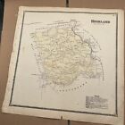
- Original 1873 Atlas Map Highland PA Chester County A R Witmer BusinessesOpens in a new window or tab$65.00+$5.61 shippingwendasplendastuff (3,898) 100%
- Vintage Map Of Reading PA & Surrounding Communities Berks County 1954 - e4 sbOpens in a new window or tabPre-Owned$14.94+$5.31 shippingthecluttercrew (11,790) 99%
- Kane PA McKean County Old USGS Topographical Geological Survey Quadrangle MapOpens in a new window or tab$9.95+$7.83 shippingFree returnsTop Rated Plusoldsol (14,873) 100%
- 1872 Hand-Colored Atlas Map Of Oxford, Adams Co., PA 15-3/8” x 13-5/8”Opens in a new window or tab$24.95+$14.80 shippingrobinrarebooks (2,325) 100%
- Original Lake Wallenpaupack Area Map Hand Drawn Property Map From 1950Opens in a new window or tab$695.00+$25.00 shippingmariarmama (117) 100%
- HISTORIC 1883 Map of the Town of East Pikeland, PA - Property Specific DetailOpens in a new window or tab$135.00+$9.00 shippingbook14850 (3,441) 99.3%
- 1925 Antique PHILADELPHIA Pennsylvania City MAP Street Map of Philadelphia 1513Opens in a new window or tab$19.50+$4.00 shippingFree returnsTop Rated Plusplaindealing (26,123) 100%
- 1869 Atlas Map: Litchfield Township, Bradford County., Pa. With Names, Etc.Opens in a new window or tab$7.50+$5.90 shippingFree returnsmr.books (5,785) 99.8%
- 1874 Philadelphia Camden Mitchell antique map 23.8" x 15.2" rare Ziegler McCurdyOpens in a new window or tab$275.00+$10.00 shippingelectronics_revolutionizers (1,865) 100%
- 1872 Hand-Colored Atlas Map Of Reading, Adams Co., PA 15-3/8” x 13-5/8”Opens in a new window or tab$24.95+$14.80 shippingrobinrarebooks (2,325) 100%
- New Cumberland PA County Old USGS Topographical Geological Survey Quadrangle MapOpens in a new window or tab$9.95+$7.83 shippingFree returnsTop Rated Plusoldsol (14,873) 100%
- 1884 Pennsylvania Geology Map Centre County Agricultural College Iron Works PAOpens in a new window or tab$28.00Was: $35.0020% off+$4.99 shippingFree returnsTop Rated Plusc574778 (15,785) 99.6%
- Blueprint Map Of Berks County-1954 Dept. Of Highways, Commonwealth Of PaOpens in a new window or tab$100.00+$6.00 shippingbenns16 (1,646) 99.8%
- 1878 Geological Map - Butler County Pennsylvania - by Lesley - PA Geology SurveyOpens in a new window or tab$11.99Was: $14.9920% off+$4.99 shippingFree returnsTop Rated Plusc574778 (15,785) 99.6%
- Huge 1979 Geological Survey Map Of Franklin County PennsylvaniaOpens in a new window or tab$15.00+$5.00 shippingpaknockerstiffer (866) 100%
- C. 1873 Hand-Colored Atlas Map Of Bear Creek, Luzerne Co., PA 15.25 x 12.75”Opens in a new window or tab$35.00+$12.50 shippingrobinrarebooks (2,325) 100%
- C. 1880 Atlas Map Of East Fallowfield Twp., Chester Co., PA 20.5 x 27.5”Opens in a new window or tab$25.00+$12.50 shippingrobinrarebooks (2,325) 100%
- 1876 Plat Map ~ HAMBURG Bor. BURKS Co. PA Ancestry Genealogy Land HistoryOpens in a new window or tab$45.95Was: $48.886% offFree shippingmaphatter (7,644) 99.6%
- 1884 Pennsylvania Geology Map Cambria County Johnstown Ebensburg Fallentimber PAOpens in a new window or tab$27.99Was: $34.9920% off+$4.99 shippingFree returnsTop Rated Plusc574778 (15,785) 99.6%
- ORIGINAL 1875 Lancaster PA Map - Warwick Township - Elizabeth Farms Etc. Illus.Opens in a new window or tab$24.99Free shippingbretts (46,061) 99.8%
- Antique 1900 Map of Pennsylvania By Rand McNally & Co - Philadelphia On ReverseOpens in a new window or tab$17.77+$4.00 shippingFree returnsTop Rated Plusp-b-antiques (7,994) 100%
- c 1949 Antique Map Pennsylvania Philadelphia Pittsburgh Harrisburg Erie ReadingOpens in a new window or tab$12.00Was: $15.0020% off+$4.99 shippingFree returnsTop Rated Plusc574778 (15,785) 99.6%
- 1878 antique foldout YORK County PA GEOLOGICAL MAP color minesOpens in a new window or tab$87.95+$6.95 shippingFree returnsTop Rated Plusantique.cottage (12,559) 100%
- ADC Street Map Of Philadelphia, Vicinity & Map Of Montgomery Co PA 13th EditionOpens in a new window or tabPre-Owned$29.99+$4.00 shippingraytubes (870) 100%
- ORIGINAL 1875 Map of Pennsylvania from Lancaster PA County Atlas - Double PageOpens in a new window or tab$24.99Free shippingbretts (46,061) 99.8%
- ORIGINAL 1875 Lancaster PA Map - Earl Township, Upper Leacock Township, EphrataOpens in a new window or tab$24.99Free shippingbretts (46,061) 99.8%
- ORIGINAL 1875 Lancaster PA Map - Columbia Borough, Little Britain, Sadsbury TwpsOpens in a new window or tab$24.99Free shippingbretts (46,061) 99.8%
- C. 1865 Hand-Colored Atlas Map Of Waterford, Erie County, PA 15.5 x 15.25”Opens in a new window or tab$50.00+$12.50 shippingrobinrarebooks (2,325) 100%
- Mt. Jewett PA McKean County USGS Topographical Geological Survey Quadrangle MapOpens in a new window or tab$9.95+$7.83 shippingFree returnsTop Rated Plusoldsol (14,873) 100%
- Original 1873 Atlas Map Warwick PA Chester County A R Witmer BusinessesOpens in a new window or tab$65.00+$5.61 shippingwendasplendastuff (3,898) 100%
- ANTIQUE Colored Map of MONTROSE - PENNSYLVANIA / A. Pomeroy & Co. 1872Opens in a new window or tab$165.00+$7.00 shippingbook14850 (3,441) 99.3%
- 1872 Hand-Colored Map of PA/Counties of Warren, McKean, Potter, Forest, ElkOpens in a new window or tab$195.00+$8.00 shippingbook14850 (3,441) 99.3%
- Items Per Page